
Some kings are remembered through their own words, cut into rock. Others are remembered only through the words of the men who fought them. Arame belongs to the second kind. In the ninth century BCE he became the earliest ruler clearly tied to the kingdom of Urartu, and no royal inscription of his own has ever been found. Nearly everything known about him comes from the annals of Shalmaneser III, the Assyrian king who marched against him. Those annals say that in 856 BCE Assyrian forces attacked and destroyed Arame’s royal city, Arzashkun, and then turned to face his army.
Nobody has located the city since. Now an archaeologist in eastern Turkey suggests it may have been sitting in the hills outside a village near Muş all along.
Lines the land did not explain
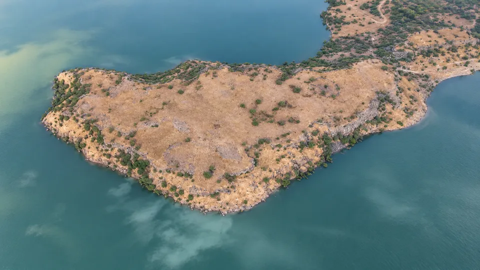
As Leman Altuntaş reported for Arkeonews, Melik Mirbey Ömeroğlu has identified a fortress about 3,000 years old near Mescidli village, a name Turkish reports also spell Mescitli. Its walls run for roughly 1.4 kilometres around an area of about 120,000 square metres, which is comparable to 17 football fields. That makes it one of the largest fortified sites recorded in the Muş region. According to Turkish press reports, Ömeroğlu calls it the largest fortress identified in Muş so far. He puts the walls at about 2 metres high on the inside and up to 4 metres in places on the outside.
It was not found by digging. It was found by looking down. Much of the architecture has collapsed and settled into the terrain. At ground level a stretch of wall here or a scatter of stone there could easily pass for natural rock. In satellite imagery of the Mescidli area, though, Ömeroğlu saw lines and patterns that the natural topography did not account for. He went to inspect them, followed the remains across the ground, and found that the pieces joined into one fortified settlement.
There is an old irony in this, offered here as reflection rather than finding. A wall is built to be seen, to warn a neighbour and impress a subject. This one was so large that, once it fell, nobody standing beside it could tell it was a wall.
Stone and water
Some sections of the fortification are built of massive stones. Ömeroğlu describes the construction as cyclopean and polygonal and compares it with Early Iron Age sites in the Van region, among them Aşağı Anzaf and Zivistan. Traces of buildings are still visible inside the enclosure in its northern sector. To the south lies a large circular feature with a radius of roughly 25 metres. It may have been used to manage water, but its exact purpose is still unclear.
Taken together, the walls, the internal structures and the sheer size point to more than a small military post. A community that needed this much defence also needed organisation and a dependable supply of water. Building it took planning, labour and resources on a scale that a minor hilltop refuge would not have commanded.
The capital before the capital
Arzashkun’s importance lies in when it stood. Later in the ninth century BCE, rulers such as Sarduri I built up Tushpa, the modern city of Van, into the kingdom’s great political centre. From there Urartu spread fortresses, inscriptions, irrigation works and administrative centres across a wide stretch of eastern Anatolia and the Armenian Highlands, and became the highly organised state known from the eighth and seventh centuries BCE. Arzashkun belongs to the dim period before that, when a regional power was only beginning to turn into a kingdom.
The Assyrians recorded the city as a trophy. On Shalmaneser’s Black Obelisk, in a widely cited translation, “Arzashkunu, the royal city of Arame” appears in a list of lands the Assyrian king claimed to have conquered. Depending on how scholars count Shalmaneser’s regnal years, the campaign is dated a year or so either side of 856 BCE. Arame himself is generally placed in the mid-ninth century BCE, as a contemporary of Shalmaneser who fought him without success.
Being known only through your conqueror is its own kind of defeat. Arzashkun has survived for almost three thousand years as a single line in an enemy’s boast.
A candidate, not a verdict
Over the years scholars have placed the city around Lake Van, near Malazgirt, and further east toward the Lake Urmia basin. Every one of these proposals depends on reconstructing the routes of Assyrian campaigns and matching ancient place names to modern ground. The texts describe landscapes and settlements that often cannot be identified with confidence today.
Ömeroğlu’s case rests on three things. The first is the site’s size. The second is its location, in a region that belonged to the western sphere of early Urartian expansion. The third is how closely its masonry resembles other Early Iron Age fortresses. None of these can put a name to a ruin, and he has not claimed they do. Turkish reports quote him calling the link to Arzashkun a possibility and saying that broader scientific research and excavation are needed before any firm conclusion.
Excavation could show when the fortress was built, how long people lived in it, and whether they had direct ties to Urartu’s earliest rulers. Pottery, radiocarbon samples and the sequence of building phases could narrow the dates. An inscription would matter most of all, because it might name the people, the rulers or the administration that held the place.
For the moment the matter rests with officials. Ömeroğlu has applied to the Van Regional Board for the Protection of Cultural Heritage to have the site registered and protected. Turkish reports say its status will be settled once the board finishes its review. The board sits in Van, the city that grew out of Tushpa, the capital that took Arzashkun’s place after Shalmaneser said he had destroyed it.